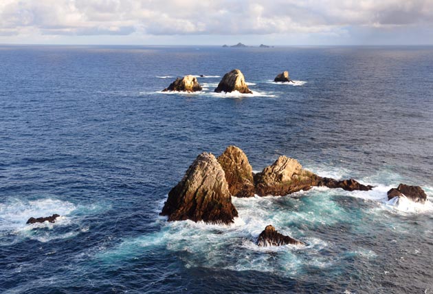
North Farallon Island is an unreachable granite island within sight of San Francisco. Although it's within the city limits, it's actually 30 miles (48 km) beyond the Golden Gate as part of the few landfalls in the Farallon National Wildlife Refuge off the California Coast in the Pacific Ocean, which is owned by the public and administered by the United States Fish and Wildlife Service. All of the Farallons except Southeast Farallon Island are considered to be wilderness.
It is shown as "closed" on a commercial map, which is the texture source. Note the resolution seems to be adequate when viewed as a map or poster or from an approximate 200 meter distance in-world. However, the underlying satellite image resolution is only one pixel per half meter, which results (in-world) in one pixel having to account for hundreds in the field of view, hence the blur at close range.
North Farallon Island substantially fits a 256 by 256 meter region and is worth virtual exploration in-world since it's impossible to visit without considerable special arrangement, such as participation in advanced scientific research. Terrestrial inhabitants are mainly a Common Murre colony of about 100,000 birds spread throughout the North Farallon Islands, and there are considerable intertidal and marine flora and fauna.
The larger Farallon islands were hunting grounds for fur seals and provided San Francisco with eggs during the 1849 California Gold Rush and for over half a century afterward. There is a small human presence and even a lighthouse on Southeast Farallon Island, as the Farallons are very close to the intersection of shipping lanes in and out of San Francisco Bay and up and down the coast. From shore, the ships are easier to see than the islands, but occasionally the largest islands are easily visible in extraordinarily clear, dry weather as a collection of very striking jagged teeth on the horizon.
This build detail consists of 143 prims of the full build, 174 prims. The region has been subdivided into 16 areas, each 64 by 64 meters that have a mesh accounting for the land area that is modeled very economically from the highest resolution contour map found, which turned out to be such a small map that it is actually slightly misleading, and 16 flat prims accounting for the ocean. Meshes were omitted on eight outer, mostly underwater, subdivisions to reduce prim count to under the 150-prim threshold. Bump and specular maps are applied to the ocean surface planes, visible with in-world viewer advanced lighting model enabled.
This particular island is the northernmost island of all the Farallons, and has several rocks offshore. One is present to the northwest and one outlying rock at northeast is clipped from the selected region. The largest rock at Southeast is present, but its mesh has been largely omitted from the detail build.
Map coordinates
Wikipedia
Webcam (down)
On view through December
Build summary
- Obtain contour map and model as 256m x 256m region in Sketchup.
- Project map texture on to model.
- Segment model to (16) 64m x 64m sub-region maximum prim size and export COLLADA.
- Import mesh.
- Create sea level flat surface and import 16 textures.
- Install to commercial rezzer.
- Apply detail, remove outer mesh prims along east and west sides to reduce prim count to 143.
- Backtrack and apply normal and specular water textures to flat prims.
Wilderness aerial


No comments:
Post a Comment